

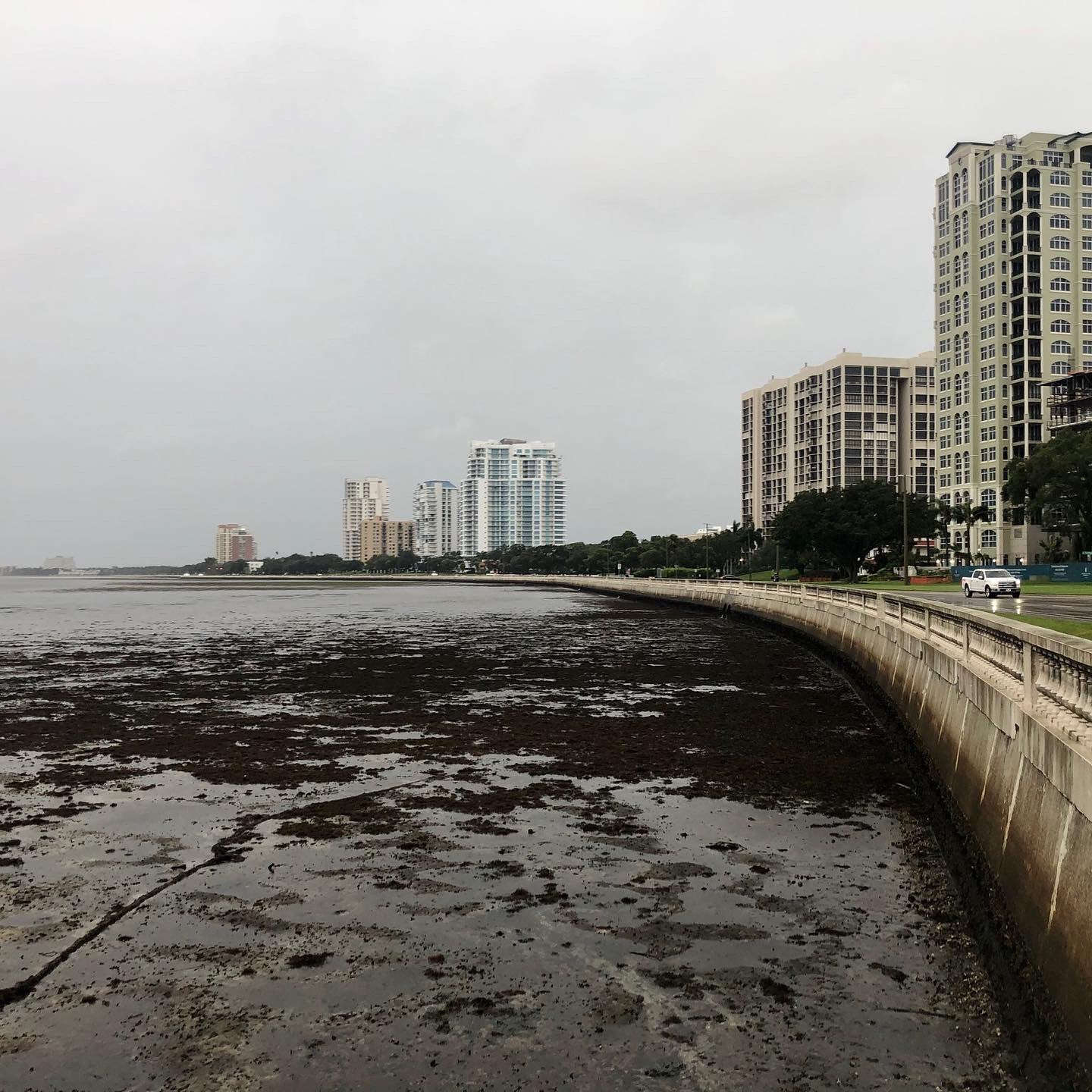
Después de atravesar el suroeste de Florida y azotar Tampa Bay con fuertes vientos y fuertes lluvias, Ian se debilitó durante la noche y se convirtió en tormenta tropical el jueves por la mañana.
After barreling through southwest Florida and battering Tampa Bay with strong winds and heavy rains, Ian weakened overnight and became a tropical storm Thursday morning.
The storm made landfall near Cayo Costa, Florida just after 3 p.m. Wednesday as a powerful Category 4 hurricane with maximum sustained winds at 150 mph.
By 8 a.m. Thursday, the storm had maximum sustained winds of 65 mph, and was about 50 miles east of Orlando, and 10 miles west of Cape Canaveral. It was moving northeast at 8 mph.
Although the storm has lost much of its strength, it is is still producing catastrophic flooding over east-Central Florida, and will likely continue to produce strong winds, heavy rains, and storm surge across portions of Florida, Georgia, and the Carolinas.
“Widespread, life-threatening catastrophic flash and urban flooding, with major to record flooding along rivers, will continue across central Florida,” the NHC said.
A couple tornadoes could be possible across east-central and northeast Florida Thursday morning, according to the NHC.
Swells from the storm are affecting Florida, and could cause life-threatening surf and rip current conditions.
The storm should move off the east-central Florida coast soon. Some re-strengthening is expected, and it could be near hurricane strength when it approaches the coast of South Carolina on Friday, according to the center.
The storm could dump another 4 to 8 inches of rain on portions of Northeast Florida, coastal Georgia, and the Lowcountry of South Carolina. Upstate and central South Carolina, North Carolina, and southern
Virginia could see 3 to 6 inches with some parts of North Carolina seeing maximum amounts of 8 inches.
The heavy rainfall will likely lead to widespread flash, urban, and river flooding in those areas over the weekend, and across portions of the southern Appalachians, where landslides will be possible.
Parts of Florida remain under a storm surge warning, meaning the storm could raise water levels above normal tides.
According to the NHC, water could reach the following heights above ground in the following areas:
- Flagler/Volusia County Line to South Santee River (4 to 6 feet)
- St. Johns River north of Julington (3 to 5 feet)
- St. Johns River south of Julington (2 to 4 feet)
- South Santee River to Little River Inlet (2 to 4 feet)
- Patrick Air Force Base to Flagler/Volusia County Line (1 to 3 feet)
- East of Little River Inlet to Cape Lookout (1 to 3 feet)
- Englewood to Chokoloskee including Charlotte Harbor (1 to 3 feet)
Here is a list of watches and warnings that are in effect as of 8 a.m. ET Thursday.
A Storm Surge Warning is in effect for:
- Flagler/Volusia Line to the mouth of the South Santee River
- St. Johns River
A Tropical Storm Warning is in effect for:
- North of Bonita Beach to Indian Pass Florida
- Jupiter Inlet Florida to Cape Lookout North Carolina
- Lake Okeechobee
A Storm Surge Watch is in effect for:
- North of South Santee River to Little River Inlet
A Hurricane Watch is in effect for:
- Flagler/Volusia County Line to the South Santee River
 Huracán Lee Categoría 5 se Acerca al Mar Caribe: Alerta y Preparación
 ¡Huracán Idalia en Movimiento!
 AUMENTAN LOS VIENTOS